The Ukrainian Carpathians: Chornogora
The name “Carpathians” derives from Albanian “karpe” (stone), and Dacian could mean “mountain”. The ancient Polish word "karpa" means "significant irregularities", "underwater stones", "large stems or roots." The name of the people - "Carpi" - "those who live in the mountains" who inhabited the Carpathians during the Roman Empire may derive from a possible Dacian meaning - "mountains".
 |
 |
 |
The Carpathians is a mountain system at the east of the Central Europe, on the territory of Ukraine, Hungary, Czech Republic, Poland, Slovakia and Romania. It extends for 1500 km, forming a convex arc, closing the Middle Danube plain. Maximum width is 430 km. The Carpathians is one of the main European watersheds between the Baltic and Black Sea.
Orographically one can distinguish the Western Carpathians, Eastern Carpathians (some of which are Ukrainian Carpathians), Beskid, Southern Carpathians, Western Romanian Mountains and Transylvanian plateau. The predominant heights of the Carpathians are 800 - 1200 m, maximum height - 2655 m (Mount Gerlachovsky-Shtit in the Tatra Mountains), Hoverla – in Ukraine (2061 m).
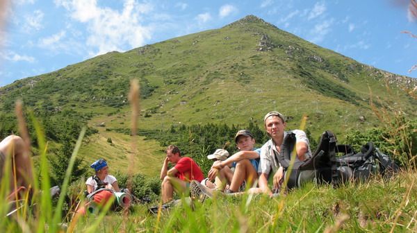
The Ukrainian Carpathians is part of the Carpathian mountain range in the West of Ukraine. The length of their upper parts of San to Suceava sources is 280 km, width is over 100 km. They occupy the territory of Transcarpathian, part of Lviv, Ivano-Frankivsk and Chernivtsi regions. The area is over 24 thousand square kilometres. Mountain ranges, separated with lengthwise lowlands and delimited with transversal deep valleys, stretch out from northwest to southeast.
Lowlands and midlands of the Carpathians are presented with mountain range of the Eastern Beskid, Gorgan and Pokutsko-Bukovina Carpathians. Central zone consists of lowlands and hollows of Vododilno-Verkhovynska region. A solid orographic core of the Polonyno-Chornohory Carpathians appears behind them. The ancient Rakhiv-Chyvchynskyi crystalline range has been preserved farther to the southwest.
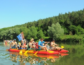
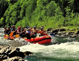
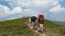
Many festivals and colourful cultural events take place in the Carpathians. For example, the festival "Hutsul brynza" (sheep cottage cheese) in Rakhiv. You will never encounter such quantity of brynza, cymbals, carpets, lizhnyks (home made wool blankets) at a place. Hosts and hostesses in uniforms, every village has its own. Here people dance, sing, treat, play at full spirit. You will be surprised with private museums of the Carpathians: Roman Kumlyk’s Museum of Antiquities in Verkhovyna with an excellent guide-host, who not only comfort with unusual stories, but also will play the ancient Hutsul instruments.
Find out more about festivals and museums in the Carpathians:
Trembitas are calling, brynza is waiting!
Carpathian miracle, or who is someone who lives near Cheremosh...
On a trip to the Carpathians and the festival "Hutsul brynza" (September, 2005)
Something about cheese and meadows
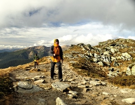
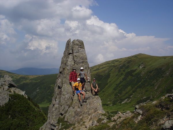
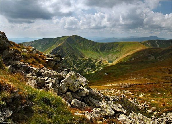
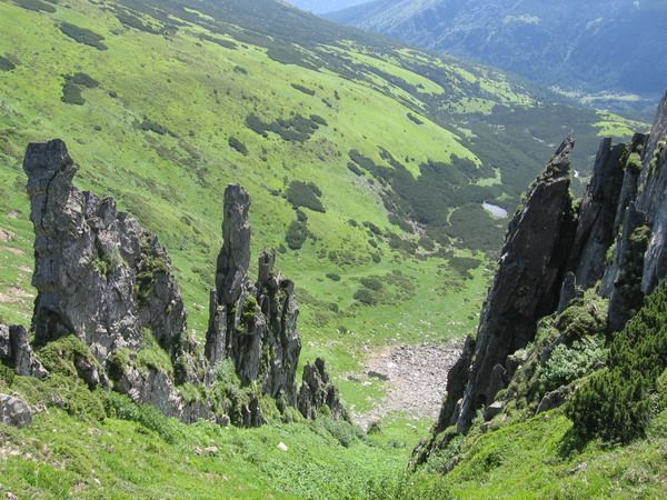
Chornohora
Chornohora is the highest mountain massif of Ukrainian Carpathians within the Transcarpathian and Ivano-Frankivsk regions. It extends for 40 km between the river valleys of the Black Tysa, White Tysa and Black Cheremosh.
Chornohora – is a steep slope midland, above which the top of the main range rises. It consists mainly of flysch, some places have slides of volcanic rocks. The slopes are deeply dissected; the top part has a distinguished Alpine relief with glacial forms (kars, troughs, and cirques). Stone screes are much common. The slopes are covered with spruce and beech forests, mountain valleys being on the top.
 |
 |
 |
All the highest peaks of the Ukrainian Carpathians - Hoverla (2061 m - the highest point of Ukraine), Brebeneskul (2032 m), Pip Ivan (2028 m), Petros (2020 m), Gutyn Tomnatyk (2016 m), Rebra (2010 m) – are concentrated on the massif of Chornohora.
The highest peaks of Chornohora
Hoverla, 2061 m
It is located on the border of Ivano-Frankivsk and Transcarpathian regions, having a conical shape. Covered with alpine meadows, shrub heaths, sometimes with stone screes. One of the sources of the Prut River, the waterfall, is at the foot.
Brebeneskul, 2032 m
Located on the border of Ivano-Frankivsk and Transcarpathian regions, with the domelike surface. It is covered with alpine and sub-alpine flora. Stone placers and screes are typical for the area.
Pip Ivan (Ivan Priest), 2022 m
Located on the southeastern end of the range on the border of Ivano-Frankivsk and Transcarpathian regions. It has a pyramidal form; also there are stone placers in the close-to-peak part. Covered mainly with sub-alpine flora. Shrubs and spruce forests are common. It got its name from the rock on top, which resembles a priest in a cassock. At the top there are the Polish observatory ruins from the early XX century.
Petros, 2020 m
Located on the northwest end of the range between mountains Sheshul and Goverla in Transcarpathian region. Western and south-western slopes are steep with numerous stone placers; north and northeast are clifflike, with rocky ledges. It is covered mainly with sub-alpine flora. Shrubs and spruce forests are common for the area.
Gutin-Tomnatyk, 2016 m
Located in the southern spurs of the main Chornohora range, within the Transcarpathian region. The lake Brebeneskul is located at the the north-eastern foot of the peak in the ancient ice kar. The mountain is covered with subalpine and alpine flora with many rare and relict species. It is a unique mountain valley and natural ancient ice complex.
Rebra (Ribs), 2001 m
Located in the central part of the Chornohora range, on the border of Ivano-Frankivsk and Transcarpathian regions. The southern slopes are flat areas (covered mainly with grass mixtures of turfy hairgrass and matgrass) and slopes covered with crooked woods. The northern slopes fall down as steep rocky cliffs. Many rare plants, listed in the Red Book of Ukraine – cedar pine, Carpathian groundsel, lying naskelnytsya , mosslike saxifrage, and others grow here.
 Other top of Chornohora
Menchul, 1999 m
Turcul, 1933 m
Breskul, 1911 m
Smotrych, 1898 m
Shpytsy, 1863 m
Dzembronya, 1877 m
Dantsyh, 1856 m
Pozhyzhevska, 1822 m
Sheshul, 1688 m
Chornohora is of great interest not only for its beautiful scenery but also for unusual objects of mountain area. Here on the Pip Ivan, on July, 29, 1938, the grand opening of astronomic and meteorological observatory, the highest located of the buildings in Ukraine, took place, with people permanently living and working there (2028 m above the sea level).
Find out more about the Polish observatory on Pip Ivan mountain:
Astronomical and meteorological observatory on Pip Ivan mountain
The observatory on Pip Ivan mountain
The unique alpine architectural and astronomical monument
Who will save the "White Elephant"?
A number of alpine mountain lakes exquisitely decorates sleek slopes of the majestic mountain peaks and harsh Chornohora range with glossy pearls: Brebeneskul, Bretskul, Nesamovyte (the highest in the Carpathians, situated at an altitude of 1750 m above the sea level on the slopes of Turkul mountain) and others.
Something on the origin of the peaks names of Chornohora range
HOVERLA 1 “hurdelytsya”(snowstorm), “zaviruha”(blizzard) (from Hungarian "Hovihar"); 2 "pidnizhnyk" (underfoot)(from Hungarian "Hovirag"). Hungarian name of Hoverla derives from "hovar." Name, and, actually, pronunciation of "Hoverla" (as it is pronounced today) came into use because of an error in the Austrian military map, later introduced to descriptive literature by L. Weigl and S. Vitvitskyi priest, the local authentic name now is completely forgotten - "Hovyrla".
PIP IVAN (Ivan Priest). Supporters of the name version Chorna Gora advance their reasons for the choice according to a legend, that on the hill, Oleksa Dovbush, the leader of opryshky rebels, killed a black trouble, the Evil. And since then the mountain allegedly is called so. Proponents of another version render narrations, according to which the mountain is called Pip Ivan, because it looks as though it is the priest in a cassock. Alternatively, long ago, Pip Ivan lived in those lands and on the Midsummer holiday (Ivana Kupala) he collected healing herbs on the mountain. Yet according to one version, the mountain is called Pip Ivan, because strong winds blow there and it seems as if mountain popivaye (sings). I will not be surprised if in each of the Carpathian villages of the region we will find its own interpretation of the mountain name origin.
PETROS - "rocky top" (from a Hungarian name).
GUTYN-TOMNATYK - "osinniy (autumn) (gray) top" (from Hung. name "oszteto", "osz" + "teto").