The Ukrainian Carpathians: Gorgany
The name “Carpathians” derives from Albanian “karpe” (stone), and Dacian could mean “mountain”. The ancient Polish word "karpa" means "significant irregularities", "underwater stones", "large stems or roots." The name of the people - "Carpi" - "those who live in the mountains" who inhabited the Carpathians during the Roman Empire may derive from a possible Dacian meaning - "mountains".
 |
 |
 |
The Carpathians is a mountain system at the east of the Central Europe, on the territory of Ukraine, Hungary, Czech Republic, Poland, Slovakia and Romania. It extends for 1500 km, forming a convex arc, closing the Middle Danube plain. Maximum width is 430 km. The Carpathians is one of the main European watersheds between the Baltic and Black Sea.
Orographically one can distinguish the Western Carpathians, Eastern Carpathians (some of which are Ukrainian Carpathians), Beskid, Southern Carpathians, Western Romanian Mountains and Transylvanian plateau. The predominant heights of the Carpathians are 800 - 1200 m, maximum height - 2655 m (Mount Gerlachovsky-Shtit in the Tatra Mountains), Hoverla – in Ukraine (2061 m).
The Ukrainian Carpathians is part of the Carpathian mountain range in the West of Ukraine. The length of their upper parts of San to Suceava sources is 280 km, width is over 100 km. They occupy the territory of Transcarpathian, part of Lviv, Ivano-Frankivsk and Chernivtsi regions. The area is over 24 thousand square kilometres. Mountain ranges, separated with lengthwise lowlands and delimited with transversal deep valleys, stretch out from northwest to southeast.
Lowlands and midlands of the Carpathians are presented with mountain range of the Eastern Beskid, Gorgan and Pokutsko-Bukovina Carpathians. Central zone consists of lowlands and hollows of Vododilno-Verkhovynska region. A solid orographic core of the Polonyno-Chornohory Carpathians appears behind them. The ancient Rakhiv-Chyvchynskyi crystalline range has been preserved farther to the southwest.
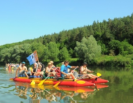
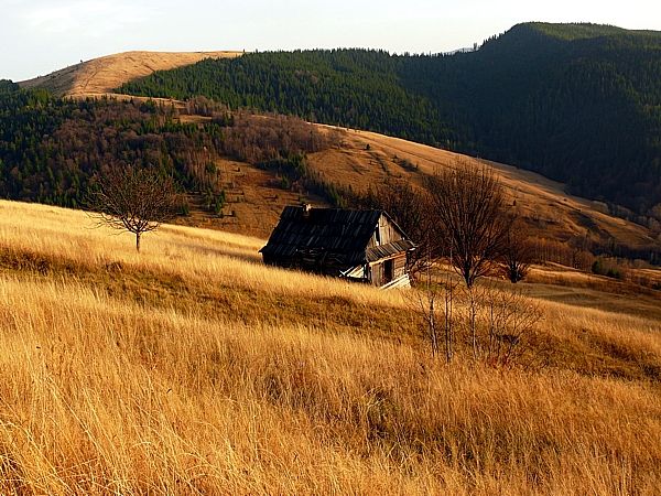
Many festivals and colourful cultural events take place in the Carpathians. For example, the festival "Hutsul brynza" (sheep cottage cheese) in Rakhiv. You will never encounter such quantity of brynza, cymbals, carpets, lizhnyks (home made wool blankets) at a place. Hosts and hostesses in uniforms, every village has its own. Here people dance, sing, treat, play at full spirit. You will be surprised with private museums of the Carpathians: Roman Kumlyk’s Museum of Antiquities in Verkhovyna with an excellent guide-host, who not only comfort with unusual stories, but also will play the ancient Hutsul instruments.
Find out more about festivals and museums in the Carpathians:
Trembitas are calling, brynza is waiting!
Carpathian miracle, or who is someone who lives near Cheremosh...
On a trip to the Carpathians and the festival "Hutsul brynza" (September, 2005)
Something about cheese and meadows
The system of mountain ranges Gorgany
Gorgany is a system of mountain ranges in the outer strip of the Skybovi Ukrainian Carpathians, which are located in Ivano-Frankivsk and Transcarpathian regions. They extend for 75 km from the northwest from the valley Myzunka and Rica, to the southeast towards the Prut valley, and the width from east to west is 40 km.
From east to west Gorgany are divided into Krayovi (Boundary) lowlands, Zovnishni (External) (Skiba) and Pryvododilni (Internal) Gorgany, and from north to south they consist of three major parts, separated one from another by deep river valleys.
In particular, Northern Gorgany are limited by Myzunka and Limnytsia and include the following peaks as Mt Moloda (Young) (1723 m), Mt Grofa (1748 m), Mt Popadya (1740 m); Central Gorgany are the highest part of the mountain range, limited by Limnytsia and Bystrica Nadvirnianska and divided in two shallow valley of Bystrica Solotvynska, includes such peaks as Mount Ihrovets (1803 m), Mt Syvulya Velyka (1836 m), Mt Syvulya Mala (1818 m); the South Gorgany are limited with valleys Bystrica Nadvirnianska and Prut, and includes the tops of Mount Bratkivska (1788 m), Mt Black Cleva (1719 m), Mt Dovbushanka (1754 m), Mt Synyak (1665 m).
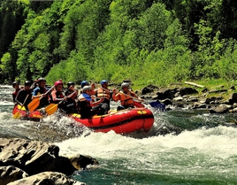
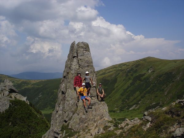
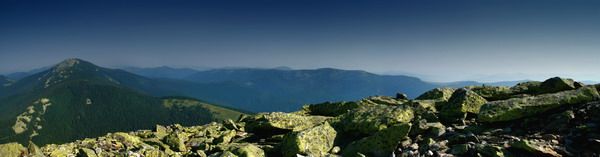
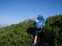
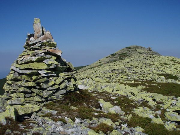
Steep slopes and sharp asymmetric ridges of mountains are typical for Gorgany, on top there are rock placers (local name "Gorgany" (accent on first syllable) or "grehoty"). The main ridges are dissected by transversal valleys of the rivers Bystritsa, Prut and Tereblya. It consists mainly of sandstone. On the rivers there are rapids, waterfalls. There are also small lakes.
 The mountain range
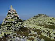

Arshytsya
Borsukova
Gorgan
Dovbushanka
Igrovyshche
Parenky
Synyak
Strymba
Homyak
The highest peaks
Blyznytsya, 1883 m
Syvulya, 1818 m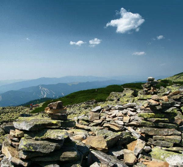 Igrovets, 1803 m
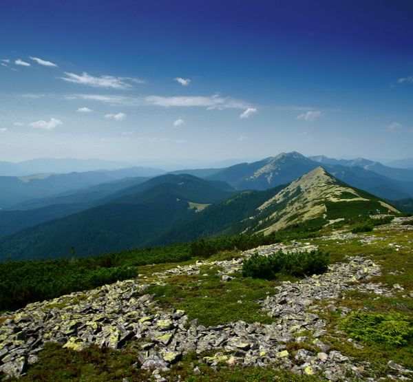
Baratkivska, 1788 m
Velykyi Petros, 1765 m
Gropa, 1763 m
Dovbushanka, 1754 m
Grofa, 1748 m
Popadya, 1740 m
Parenky, 1735 m
Moloda, 1723 m
Strymba, 1719 m
Black Kleva, 1719 m
Durnya, 1709 m
Bushtul, 1691 m
Yajko-Ilemske, 1679 m
Bert, 1666 m
Synyak, 1665 m
Yajko-Pereginske, 1595 m
Gorgan Ilemski, 1587 m
Homyak, 1544 m
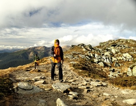
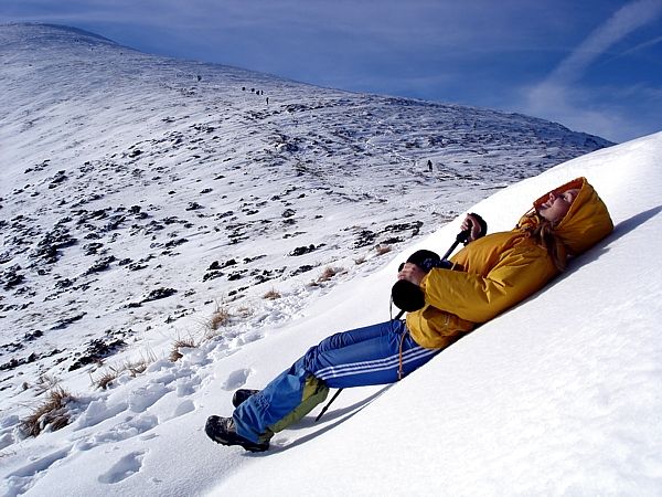
Getting around Gorgany in summer is even more interesting and complicated than around Chornohora. In Gorgany almost every top must be taken by storm, one has to pass steep rises and slopes by narrow paths covered with mountain pines or green alder. Most of the way you have to walk on loose and slippery after-rain stones (it is this stone that is called Gorgan).
The most popular tourist attraction of the Gorgany is the lake Synevyr. This is the largest mountain lake of Ukraine, which was formed about 10 thousand years ago as a result of the crash of rocks that blocked the mountain stream. It is located in the Intermountain district of Transcarpathia near the village of Synevyrska Polyana at an altitude of 989 m above the sea level. The lake has the crayfish, trout. People call the lake "the sea eye". There is an old legend, under which the lake was formed of the tears of the girl Syn, weeping for her boyfriend Vir.