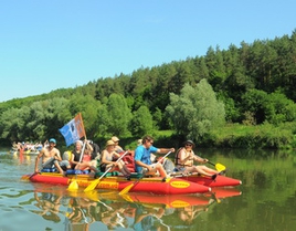
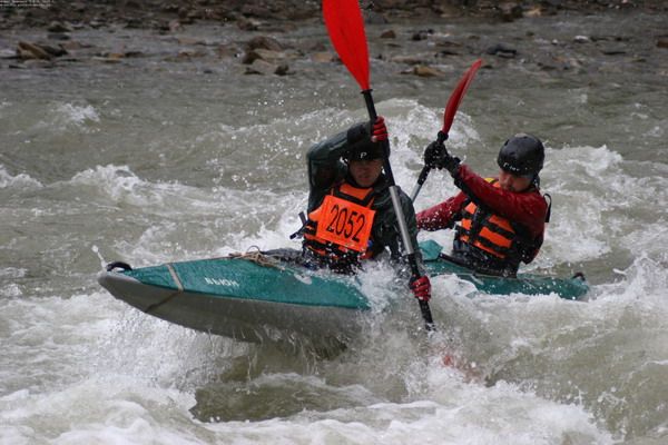
The Cheremosh river
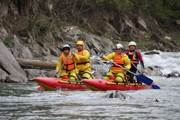
The nature of Ukraine with its rich system of the river resources gives all the possibilities for rapid development of water tourism. Particular potential in this area is concentrated in the Ukrainian Carpathians.
The most popular category water routes of the Carpathian region of Ukraine
II difficulty category
rivers Black Tysa and Tysa: towns Yasynya – Rakhiv – Solotvyno
rivers Black Tysa and Tysa: towns Bohdan – Rakhiv – Solotvyno
rivers Cheremosh – Black Cheremosh and Prut: village Krasnyk – town Vyzhnytsia – town Chernivtsi
rivers White Cheremosh – Cheremosh and Prut: dam Marien – village Usteryky – town Vyzhnytsia – town Chernivtsi
III difficulty category
rivers Black Cheremosh – Cheremosh and Prut: village Burkhut – village Usteryky – town Vyzhnytsia – town Chernivtsi
river Prut: town Vorokhta – town Yaremche (carrying around the rapid Prykarpatsky and farther to the bridge in town Yaremche)
IV difficulty category
river Prut: town Vorokhta – town Yaremche – town Chernivtsi (complicated with elements of the V difficulty category without passing Probiy waterfall)
The Cheremosh is the river in the Western Ukraine, in the Eastern Carpathians (wooded Carpathians),the right tributary of the Prut (Danube basin).
The length is 80 km, the basin area is 2560 thousands km2. It’s a typical river with the flow rate of 8 to 20 km/h, with slope of 3,3 m/km and total height difference of 280 m.
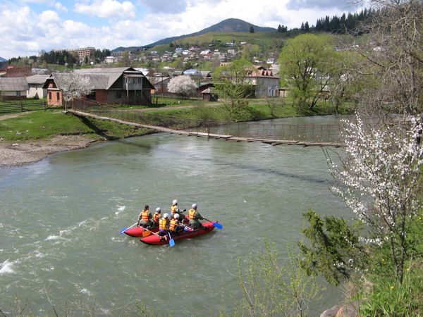
The Cheremosh rises from the confluence of the Black and White Cheremosh near the village Usterika. Within the Ciscarpathians the Cheremosh is flowing down a wide valley. The flow rate is reduced to 8 km/h, with rapids disappearing. Not far from Snyatyn the Cheremosh flows into the Prut.
Find out more about the Carpathian river Cheremosh:
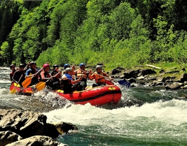
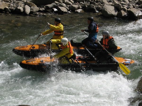
Wild waters of Cheremosh
The river Cheremosh: water routs
The Black Cheremosh
The Black Cheremosh is the left tributary of the Cheremosh: The length is 87 km, the watercollection area is 856 km2. The whole river is on the territory of Verkhovynsky district, Ivano-Frankivsk region. The Black Cheremosh rises from the sources in the Chyvchynski Mountains at the height of 1680 m above the sea level.
 |
 |
 |
Chyvchynski ridge is an area of Marmarosky crystal range of the Ukrainian Carpathians. Streams falling down from the slopes of Hrynyavski mountains are formed at the right bank of the upper course of the Black Cheremosh.
The Black Cheremosh is a typical mountain river, flowing down a narrow picturesque valley with steepy slopes, covered with a dense forest. Terraces and a small floodplain occur at some parts down the low stream. The watercourse is curvy, the width during tides is 15 – 20 m, and the depth ranges from 0.2 m up to 0.4 m at the upper course and up to 1 m at the lower stream. The average flow rate is 0,8 - 1,2 m/s. At the maximum water levels the width of the watercourse increases to 50-80 m, and flowrate - to 5-6 m/s. Average water consumption for a long period is 18 m/s at the mouth. Extreme amount of water consumption ranges from 1 m3/s during tides and up to 1100 m3/s during the floods.
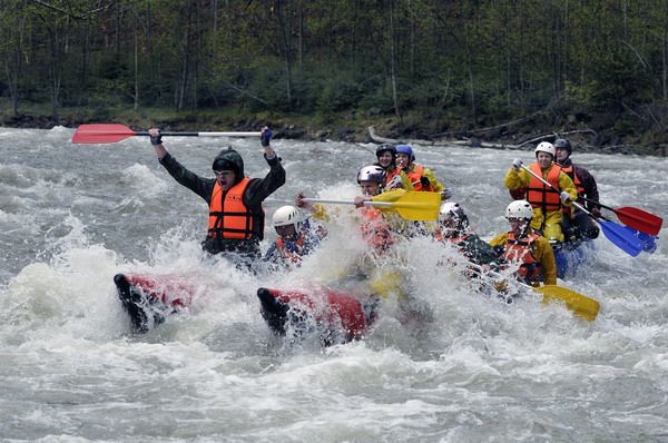
The Black Cheremosh receives many tributaries. The biggest are: Shybena, Dzembronya, Bystrets, Iltsya. It must be noted that all these tributaries are on the left and their sources are on the slopes of Chornohora where snow stays till the end of June, and in summer a lot of rain fall. Therefore, from the mouth of Dzembronya the Black Cheremosh is floatable through the whole summer. There are numerous riffles and rapids of different complexity.
Find out more about the Black Cheremosh:
The Black Cheremosh
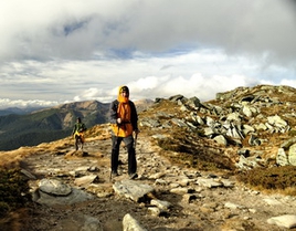
Climbing the Carpathian tops:
Mount Pip Ivan, Mount Smotrych and Hrynyavski meadows
It is on the bank of the Black Cheremosh where every spring the team of the "Tourclub" arranges the stationary rafting camp – a basic point that serves as the location of tents, vehicles, field kitchen.
Being in the Carpathians, rafting down the wild mountain river and leave the world from a bird's-eye view without seeing - it is just simply impossible. You can feel the contrast between the spring in the mountains and spring in the valley while climbing one of the Carpathian peaks, namely, Pip Ivan or Smotrych.
On top of Mt Pip Ivan - the third "rated" Ukrainian mountain at an altitude of 2028 meters above the sea level - remains of unique structures inhabited by people 65 years ago are destroyed . The Polish observatory on Mt Pip Ivan that was being built during 1937 - '38 with great efforts and lasted only for a year at use, is well known among scientists, architects and lovers of mountain travel. The observatory was used not only for scientific research, but as a military object. Despite the fact that the observatory studies were conducted almost for 14 months, this period entered the Ukrainian and Polish history. During its existence it changed owners several times, but none of them stayed here for long. First there were the Poles that just before World War II were evacuated deep into the Carpathians, then were Hungarian troops, and the Soviet power.
Find out more about the observatory on Mount Pip Ivan:
"White Elephant" at the crown of Pip Ivan
The observatory on Mount Pip Ivan
The unique alpine architectural and astronomical monument
Hryniava is he range of the Ukrainian Carpathians in the south of Ivano-Frankivsk region. It rises in the area between the White and Black Cheremosh. The height is up to 1590 m (Mt. Baba-Lyudova). The ridge line of Hrynyava is curvy with numerous tops: Roztotska (1527 m), Skupova (1583 m), Lystuvata (1525 m) and others. The western slope is short and steep, the eastern one is flat and low. Hrynyavski mountains also include the ridge Losova, stretching between the White Cheremosh and top of Suchava. Slopes up to 1350 - 1400 m are usually covered with coniferous forests (spruce, fur), above there are meadows. The area of grazing livestock is significantly populated.
The White Cheremosh
The White Cheremosh is the right tributary of Cheremosh that together with the Black Cheremosh gives rise to Cheremosh. The length is51 km, the watercollection area is 632 km2. The river is a natural border between Chernivtsi and Ivano-Frankivsk region.
 |
 |
 |
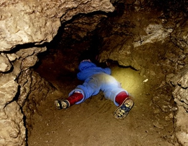
It starts after the merger of the rivers Perkalab and Sarata in the village of Perkalab an altitude of 947 m above the water level. Perkalab collects water from the slopes of Hryniava mountains and western slopes of the ridge Black Dil (the highest point - Mount Black Dil, 1493 m) and the river Sarata - from the eastern slopes of the ridge Black Dil and western slopes of the ridge Yarovytsya (Mt. Yarovytsya, 1580 m). Black Dil is a ridge with abrupt rocks, caves with limestone and unique flora.
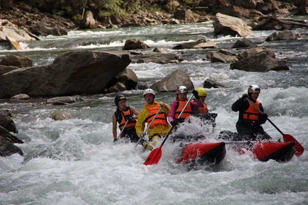
From the very source the White Cheremosh flows down a narrow valley with very steep slopes covered with pine forests, only near the mouth small expansions of the valley appear where villages are located. The slope of the riverbed reaches 14 m/km, the flow is very fast. Rapids are difficult to pass, there is a whole set of obstacles on the river that are typical for mountain rivers.
The best time for rafting down the White Cheremosh is spring months when high water level is permanent. Once there were water-regulating structures, hamovanky (water reserves), dams on the rivers etc. They accumulated water in small water storages in order to use it for rafting timber. This system operated all year, except for some winter months.
Now there are only recollections of exotic profession of the mountain river in memory, poems and songs about brave rafters. Today bokorashi (water collectors) are only mentioned sometimes: darabs (rafts) have become a legend. In August 1979 the last raft of the Carpathian forest passed through. Today, water-regulating structures are dismantled and the White Cheremosh entered its usual riverbed, which shallows during summer months, and in spring and during the rains is filled and wild, casting with fury on the stone banks.
Find out more about the White Cheremosh:
The White Cheremosh River
The Prut
The Prut is the left tributary of the Danube: Its sources lie on the slopes of the highest top of the Ukrainian Carpathians, Mt Hoverla.
Between Hoverla and the first top behind named Bretskul there is great and very high circus – it is a famous "bretskul boiler", a cradle of the Prut. Of the almost vertical slopes of the circus, noisy brooks are falling down to the bottom, and, mingling there, are running down by not a vast river, into which, from the left, then right the streams are flowing into with noise. Here takes birth the Prut.
The length of the “pothole” is about 2 km. And here, after 2 km a big precipice appears. And the Prut has nothing but to fall down with a terrible roar over eroded with water stone blocks. This is how the many-stage waterfall Huk was created, with the height of 50 m. This fantastic water falling can not even be compared to Yaremchanskiy waterfall, "tamed" by tourists-waterlovers.
The riverbed is curvy, the slopes of the valley are steep, convex, much slit with gorges of the streams and covered with forests.
At the upper stream the Prut and its tributaries are mountain rivers, with rocky rapidfull riverbed - creating waterfalls in some areas. The slope of the riverbed reaches 10 m/km, the flow rate is from 8 to 15 km/h.
The wild and dashing nature of the river is in its name "Poratus", which is translated from Latin as "fast, fiery". A considerable number of tributaries flows into the Prut, the most significant are: on the left – the Rakovets, the Chuhur; on the right – the Cheremosh and the Zhyzhya with the Bahlui, known for their beauty and picturesqueness.
The best time for rafting is spring as for all Carpathian rivers, and from Dylyatyn - the whole summer. Rafting without problems can be started from Vorokhta. The width of the river is 20 m, the depth is 0.5 m, there are some stones in the riverbed, the current is fast.
Find out more about the dashing waters of the Prut and Black Tysa:
The Prut River
The Black Tysa river